News
End of Season Field Reports
2012-2013 Field Season
Collaborative Research: Climate, Ice Dynamics and Biology Using a Deep Ice Core from the West Antarctic Ice Sheet Ice Divide (I-477)
PI: Ken Taylor (Desert Research Institute) NSF-OPP supported
PI: Mark Twickler (University of New Hampshire) NSF-OPP supported
Collaborative Research: Replicate Coring at WAIS Divide to Obtain Additional Samples at Events of High Scientific Interest (I-476)
PI: Jeff Severinghaus (Scripps Institution of Oceanography) NSF-OPP supported
PI: Jihong Cole-Dai (South Dakota State University) NSF-OPP supported
PI: Ed Brook (Oregon State University) NSF-OPP supported
Field Team:
Don Voigt1,6, John Fegyveresi1, Bradley Markle2, Emily Longano3, Ross Beaudette4, Jihong Cole-Dai5, and Kari Peterson5
1 Penn State University
2 University of Washington
3 University of Colorado-Boulder
4 Scripps Inst. of Oceanography, UC-San Diego
5 South Dakota State University
6 2012-13 WAIS Divide Chief Scientist and SCO Representative
Field Season Tasks:
The first task for season was to use the newly-developed DISC Drill Replicate Ice Coring System to collect 252 meters of replicate core from five of the most interesting time periods in the WAIS Divide climate record by deploying into the main 3,405 meter deep borehole and then actively deviating from it at specific depth (e.g. time) intervals of high scientific interest. The goal was to deviate on the uphill side of the main borehole, thereby maintaining the ability of logging tools to make measurements in the entire main borehole. The second task for the season was to remove the chips that accumulated in the main borehole as a result of the replicate coring process.
Task 1 Replicate Coring:
The put-in crew, led by Camp Manager Kaija Webster, made it to WAIS Divide on October 26 after waiting only one day for favorable weather. This is the first time in many seasons there was a deep field put-in before November 1. Don Voigt arrived in McMurdo station on 17-Nov and quickly made it to WAIS Divide on 22-Nov. John Fegyveresi, Brad Markle, Emily Longano and Ross Beaudette arrived to McMurdo on 28-Nov and then to WAIS Divide on 7-Dec. Due to a combination of good weather when we needed it to get people and equipment in to camp and to great camp staff support, the IDDO drilling team was able to start using the replicate drilling equipment down hole about 10 days sooner than expected.
The field team was able to surpass the initial goal of 252 meters of replicate core, collecting a total of 285 meters of excellent ice core from all of the depth intervals of interest. In addition, each deviation was successfully carried-out on the uphill side of the main borehole, thereby maintaining the ability of logging tools to make measurements in the entire main borehole. This is the first time replicate coring has been carried-out while retaining access to the main borehole. At the conclusion of each deviation, a logging tool equipped with a weight-on-bit sensor was lowered past the depth of deviation to demonstrate that logging tools can successfully pass the deviation. Table 1 summarizes the starting and ending depths of each deviation.
| Deviation # | Coring Start Depth (m) | Full Diameter By (m) | Coring End Depth (m) |
| 1 | 3001.55 | 3006.16 | 3100.26 |
| 2 | 2416.70 | 2420.02 | 2469.49 |
| 3 | 2221.00 | 2226.16 | 2290.80 |
| 4 | 1952.00 | 1956.90 | 2000.20 |
| 5 | 2414.50 | 2420.02 | 2428.74 |
Table 1. Summary of the five replicate coring deviations carried-out during the 2012-2013 field season. Deviation #1 corresponds to AIM8 and the Laschamp Event. Deviation #2 corresponds to the 18 ka event. Deviation #3 corresponds to the Bølling-Allerød event. Deviation #4 corresponds to the Younger Dryas event. Deviation #5 corresponds (again) to the 18 ka event.
Fugitive Gas Sampling
Ross Beaudette collected ice samples for fugitive gases (helium, neon, oxygen), within half an hour of the core being brought to the surface, and sealed them in gas-tight bottles. Fugitive gas samples were collected mostly from deviation #1, plus four samples from deviation #2. The samples were 10 cm long and consumed the entire cross section. Table 2 lists the fugitive gas samples collected during the field season.
| Deviation # | Bottom Depth (m) |
| 1 | 3005.008 |
| 1 | 3009.497 |
| 1 | 3011.9 |
| 1 | 3015 |
| 1 | 3020.1 |
| 1 | 3023 |
| 1 | 3029 |
| 1 | 3032 |
| 1 | 3037.1 |
| 1 | 3040 |
| 1 | 3043 |
| 1 | 3046 |
| 1 | 3049 |
| 1 | 3054.28 |
| 1 | 3057.1 |
| 1 | 3061 |
| 1 | 3064 |
| 1 | 3068 |
| 1 | 3072.31 |
| 1 | 3076 |
| 1 | 3079 |
| 1 | 3082 |
| 1 | 3088.36 |
| 1 | 3091.1 |
| 1 | 3095 |
| 1 | 3098 |
| 2 | 2469.42 |
| 2 | 2469.31 |
| 2 | 2469.2 |
| 2 | 2469.09 |
Table 2. Fugitive gas samples taken during the 2012-2013 field season replicate coring. Each sample was 10 cm long and consumed the entire cross section.
Replicate Coring Process
The DISC Drill Replicate Ice Coring System collected additional ice at depths of interest by deploying into the existing 3,405 meter borehole and then actively deviated from it. The drill used two steering actuator sections to tilt itself in the main borehole by applying sideward force against the borehole wall. In the first step of the process, the broaching cutter head was deployed to the target depth. Using the actuators, the drill was then tipped to the high ("up hill") side of the borehole to engage the cutters. Ice was then removed in repeated passes of approximately 15 meters in the up-stroke. In the second step of the process, a milling head was deployed to create a landing for the coring head. In the third step of the process, a coring head removed a 20 mm kerf allowing a 108 mm diameter core to enter the core barrel. Two meters of core were removed per trip. The coring was repeated until all of the desired replicate ice from the target depth was obtained.
Task 2: Remove Chips from Main Borehole
The process of replicate coring created chips that fell to the bottom of the main borehole. We had a problem when we tried to clean the chips from the bottom of the main borehole and came very close to sticking the replicate coring drill due to ice refreezing on the drill head. We think the chips behaved like toothpaste when the drill tried to core, and oozed around the drill head rather than cutting like ice would. The chips then refroze on the cold drill. Tension during core break was about 10,000 N, which is within 2,000 N of the highest core break seen, even though there was no core to break, just chips. The drill was then reconfigured with the DISC coring head (which is a larger diameter head than the replicate coring head) used for drilling the main borehole to see if that configuration yielded better success. However, we were only able to get to a depth of 2498 meters before having to ream. This proceeded at a rate of 20 mm/sec. Given the remaining depth to the chip pack, the volume of chips that would be produced by this process, and the time available, it became clear that we would not reach the bottom of the borehole before the end of the season. The difficult decision was then made to call it a season and leave about 12 meters of chips at the bottom of the borehole; touch-off was at 3393 meters depth. While we are disappointed not to be able to leave a pristine hole to 3405 meters, the risks involved (i.e., a stuck drill) outweighed the scientific benefits of a chip-free hole to 3405 meters.
This brings the core collection phase of the WAIS Divide project to a close. It has taken eight field seasons to prepare for drilling, collect the main core, and collect replicate cores from five intervals. It will take another two field seasons to complete the repeat borehole logging and remove the camp and drill arch. It has been a wonderful journey and we thank everyone that contributed in any way to the effort.
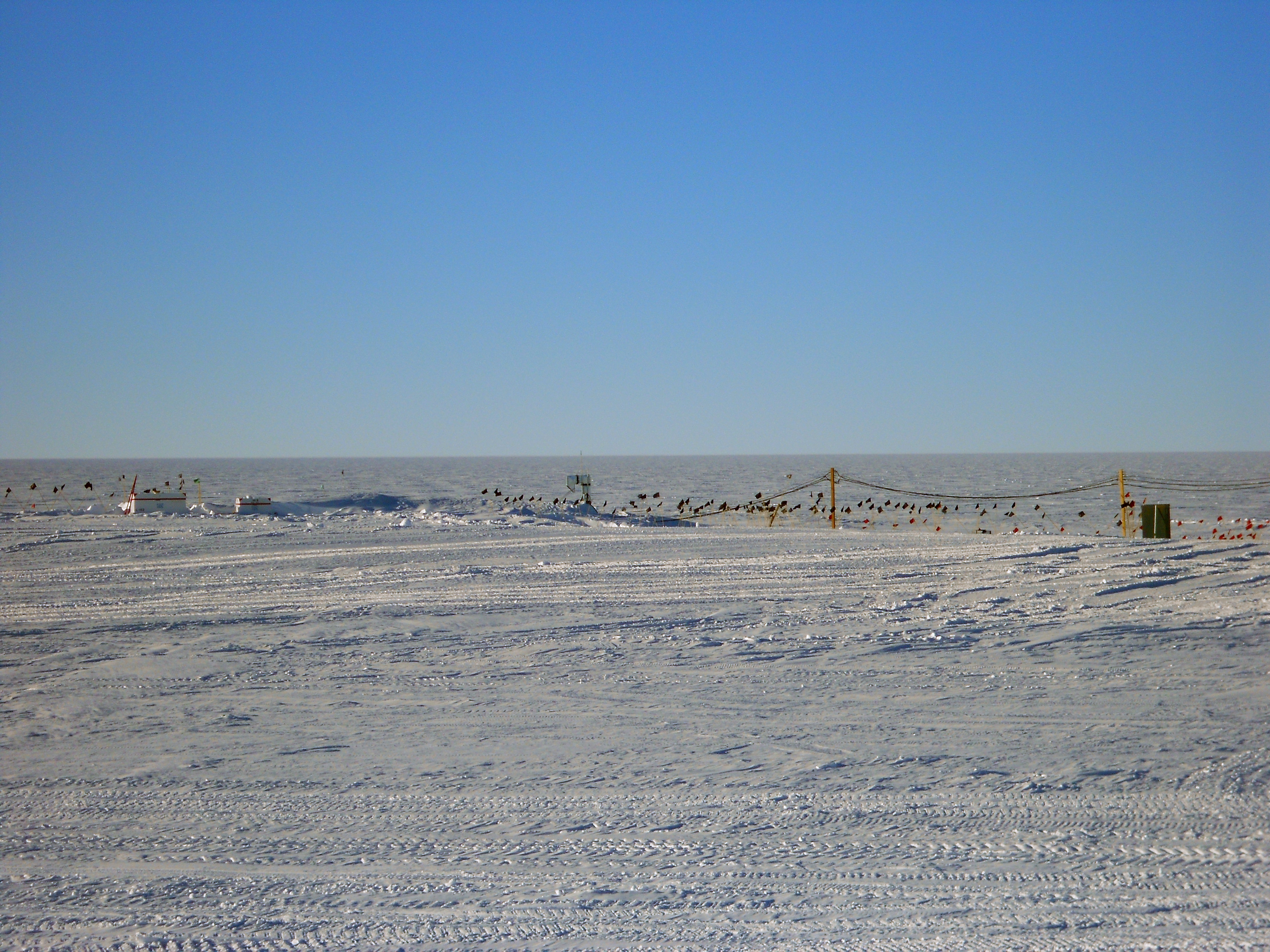
Fig. 1: View of the (buried) arch at the end of the 2012-2013 field season. The power poles on the right-hand side of the photo lead back towards camp. The ventilation conduit in the center of the photo marks the start of the drilling arch, which then runs 100-feet to the left. The core handling arch runs to the right of the conduit for 84-feet. Photo: Don Voigt.
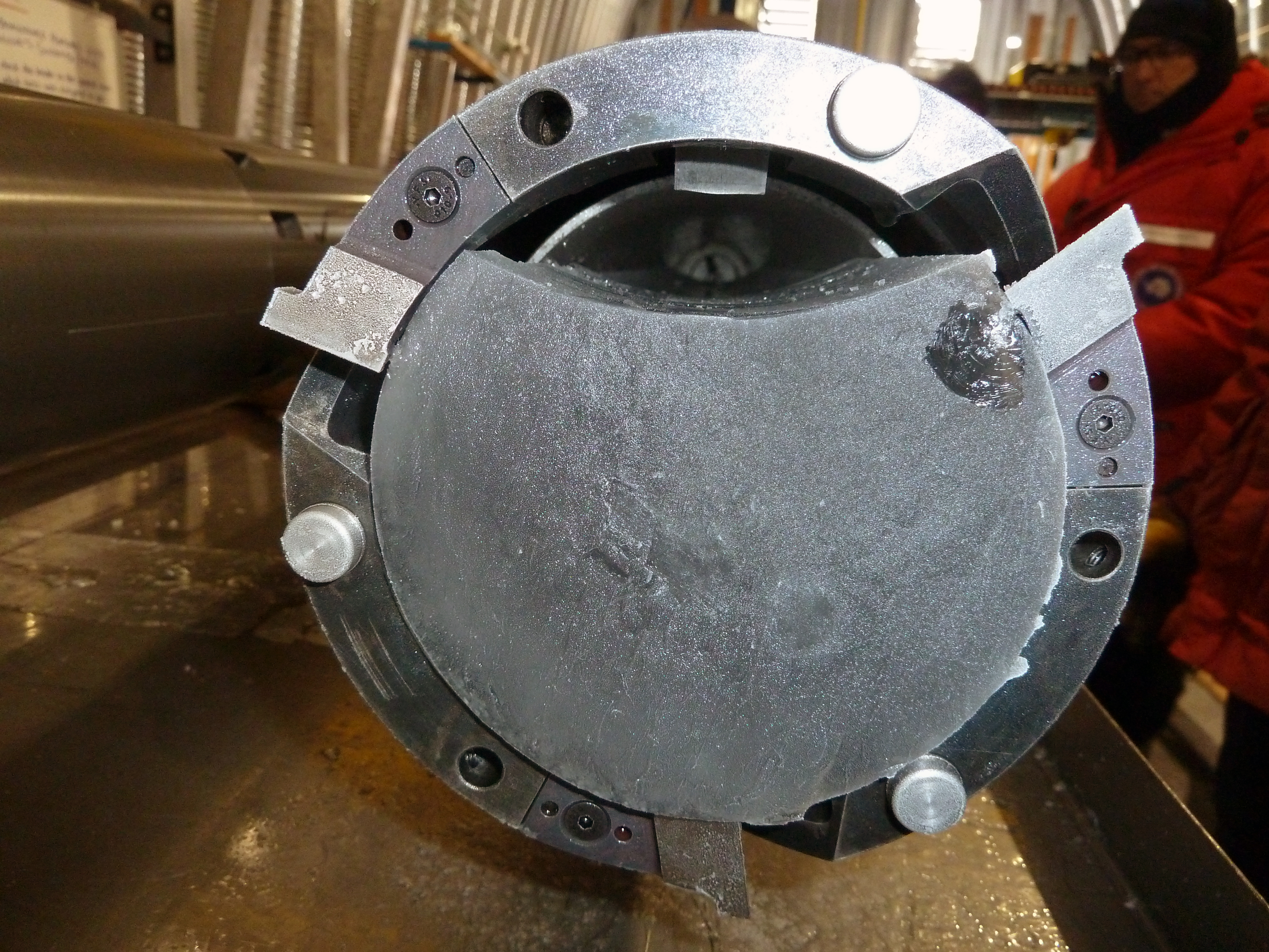
Fig. 2: On Monday, 17 December 2012 at 2:10 PM the first-ever replicate ice core taken from the high-side of the borehole was successfully drilled from 3001 meters depth in the WAIS Divide Ice Core borehole in West Antarctica. The first replicate core was ~80% of a full round core, but as the drilling continued on the new path 100% round cores were obtained. Photo: Jay Johnson/IDDO.
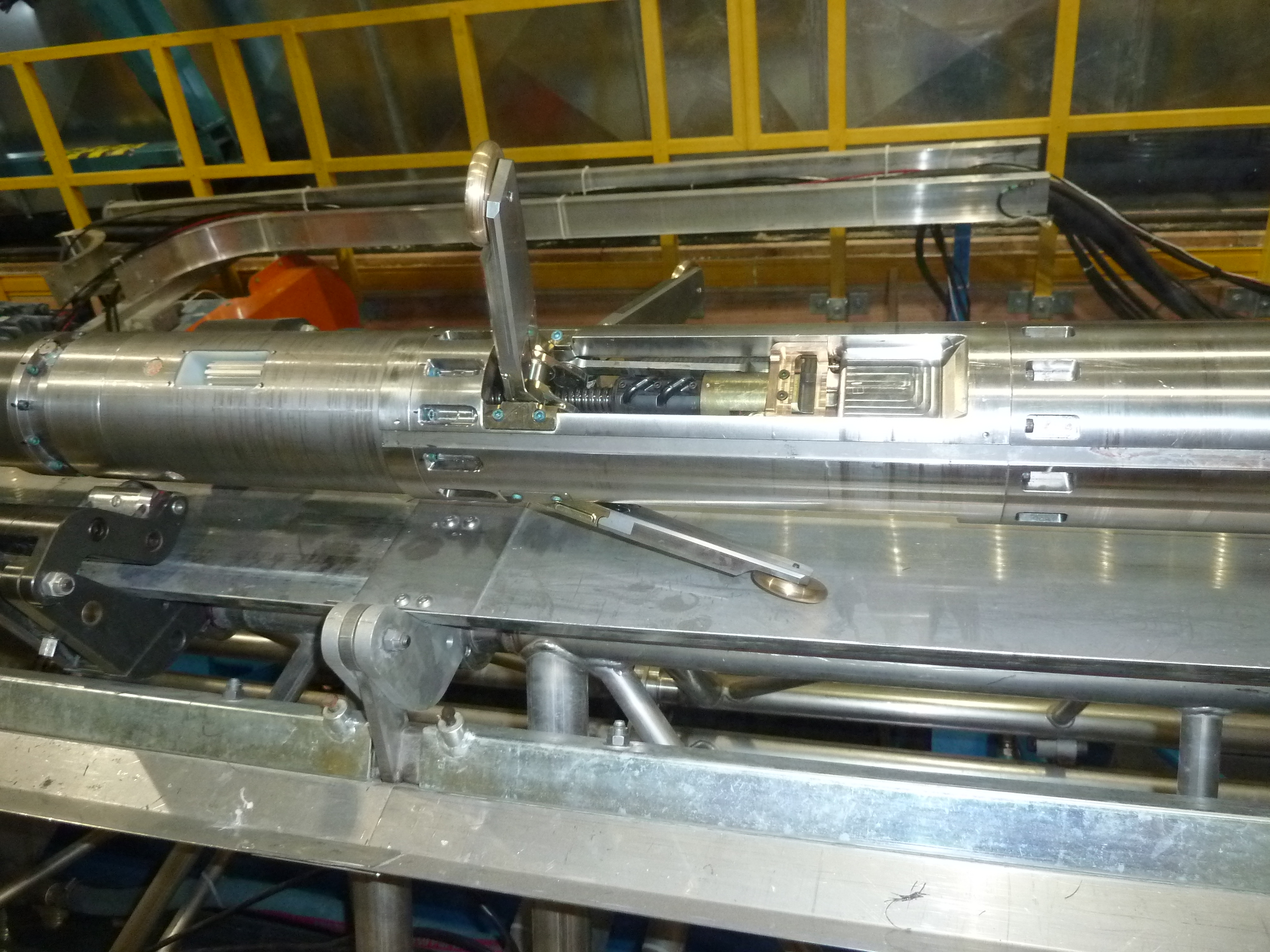
Fig. 3: Replicate coring system actuator section. Photo: Chris Gibson, UW-Madison/IDDO.
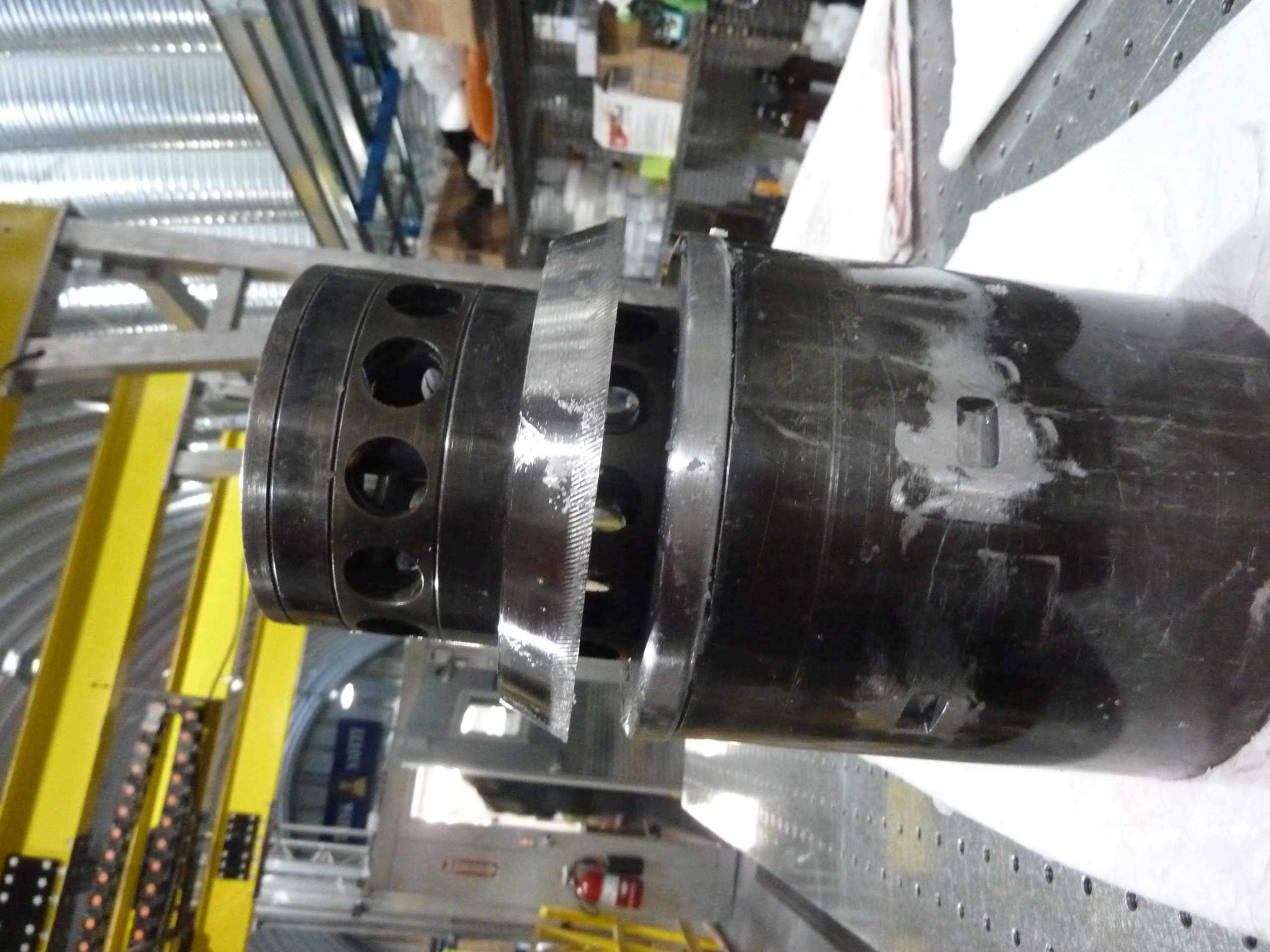
Fig. 4: Replicate coring system broaching head. Photo: Chris Gibson, UW-Madison/IDDO.
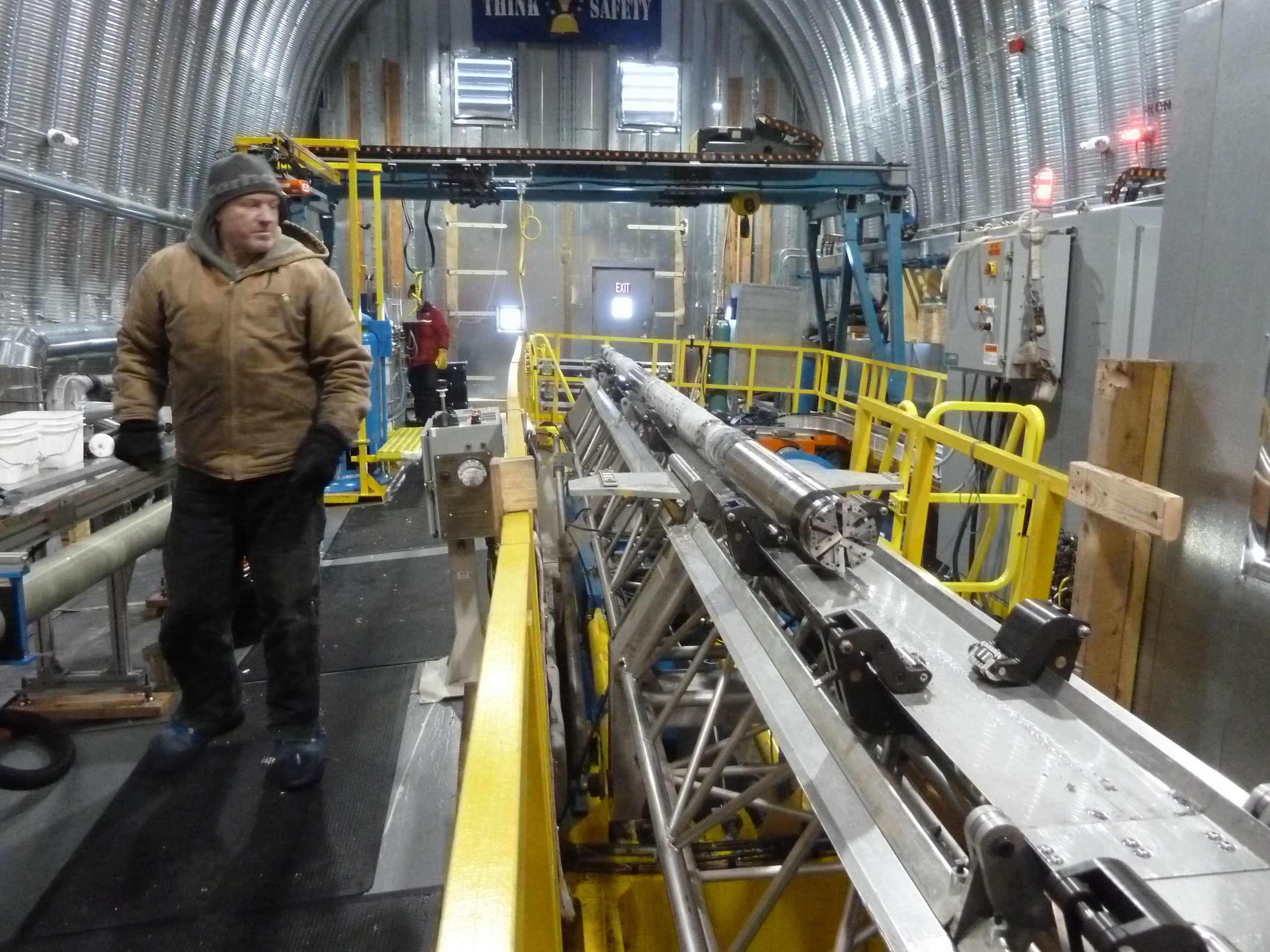
Fig. 5: Replicate coring system milling head. Photo: Chris Gibson, UW-Madison/IDDO.
Supplementary Science #1: Recent Temporal and Spatial Climate Variability Around the WAIS Divide Site - Bradley Markle
This season, 2012/13, I led a side project to quantify recent temporal and spatial climate variability around the WAIS Divide site. With the tremendous help of Don Voigt, John Fegyveresi, Emily Longano, Ross Beaudette, Graham Colegrove, and Jeremy Miner, we collected a series of five shallow firn cores in a transect extending 40 km from the WAIS Divide drilling site, up and over the main ice flow divide (~20 km from camp). Cores were drilled every 10 km along the transect to depth of 10 to 12 m, which should allow for the analysis of the last couple decades of accumulation. A 1.5 meter snow pit was also dug at each firn core site to enable high resolution sampling of the upper, loosely consolidated snow. Additionally surface snow samples were taken during and immediately after several precipitation events at the WAIS Divide site. These cores and samples will be analyzed at the University of Washington's Stable Isotope Laboratory, for stable water isotope ratios, a widely used proxy for past temperatures and circulation. This project involved several extended snowmobile traverses away from the main camp, including one overnight trip, all of which went extremely well. A huge debt is owed to the core handlers and camp staff whose efforts and enthusiasm made this possible. The drill used for this project was a prototype hand auger designed and provided by Josh Goetz of IDDO, which worked extremely well thanks to his expertise and that of Jay Johnson.
The aim of this study is to better understand the recent spatial and temporal variability of WAIS Divide, building on previous work. This will have many applications toward better understanding the deep ice core record, such as extending the climate record through the most recent decade, correcting for the possibility of ice flow through local temperature or isotopic gradients, and quantifying the level of spatial and temporal "climate noise" at the site. An important part of this project will also involve understanding the recent atmospheric circulation that lead to the deposition of the snow that constitutes these firn cores. To that end, I conducted atmospheric back-trajectories modeling of the last 30 years while at camp this season, which I aim to combine with isotope models in the near future.
All field aspects of this project went extremely well. I'm very excited to begin analyzing the results!
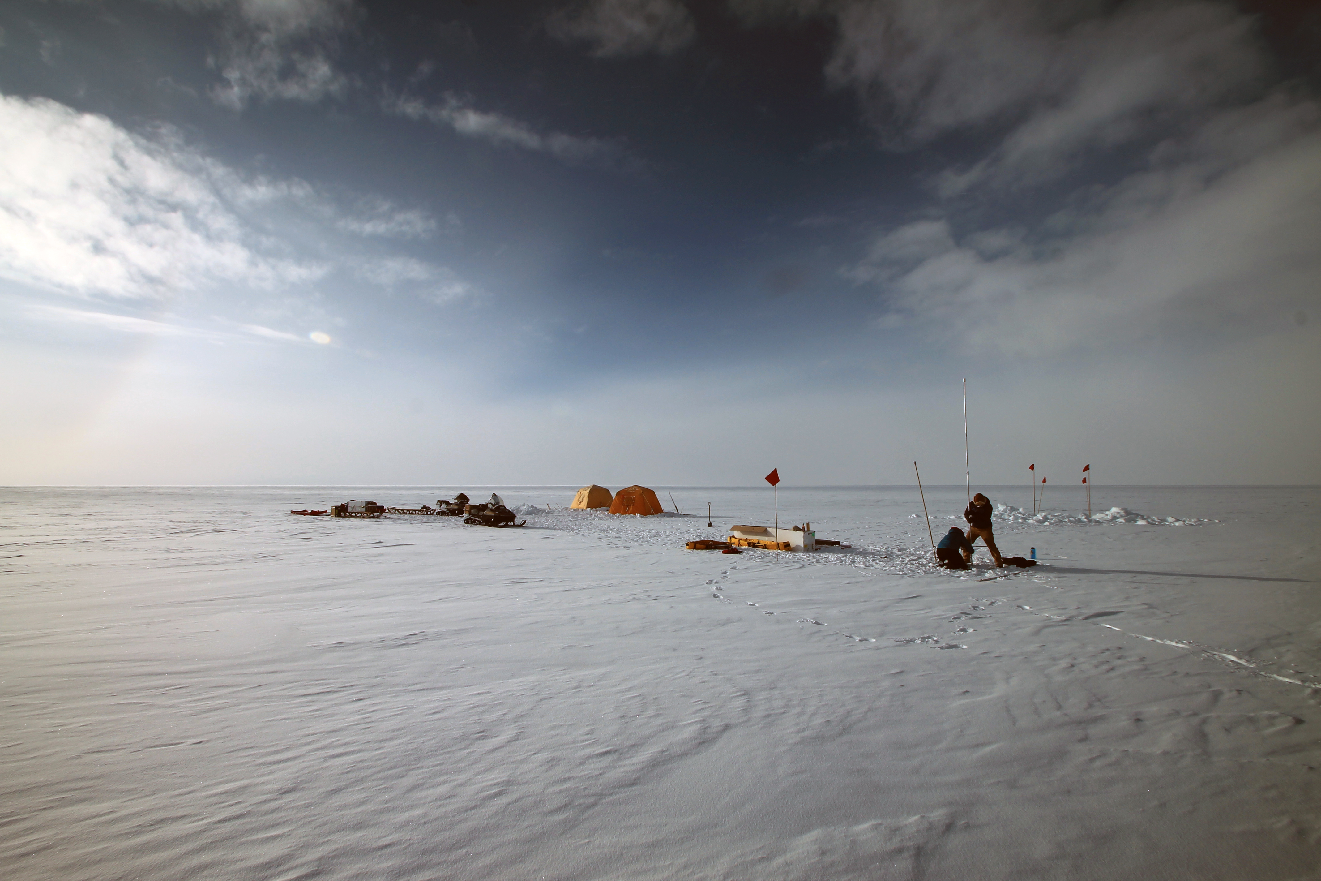
Fig. 6: Brad Markle and Emily Longano drill a shallow ice core on the main ice divide of the West Antarctic Ice Sheet. Photo: Graham Colegrave.
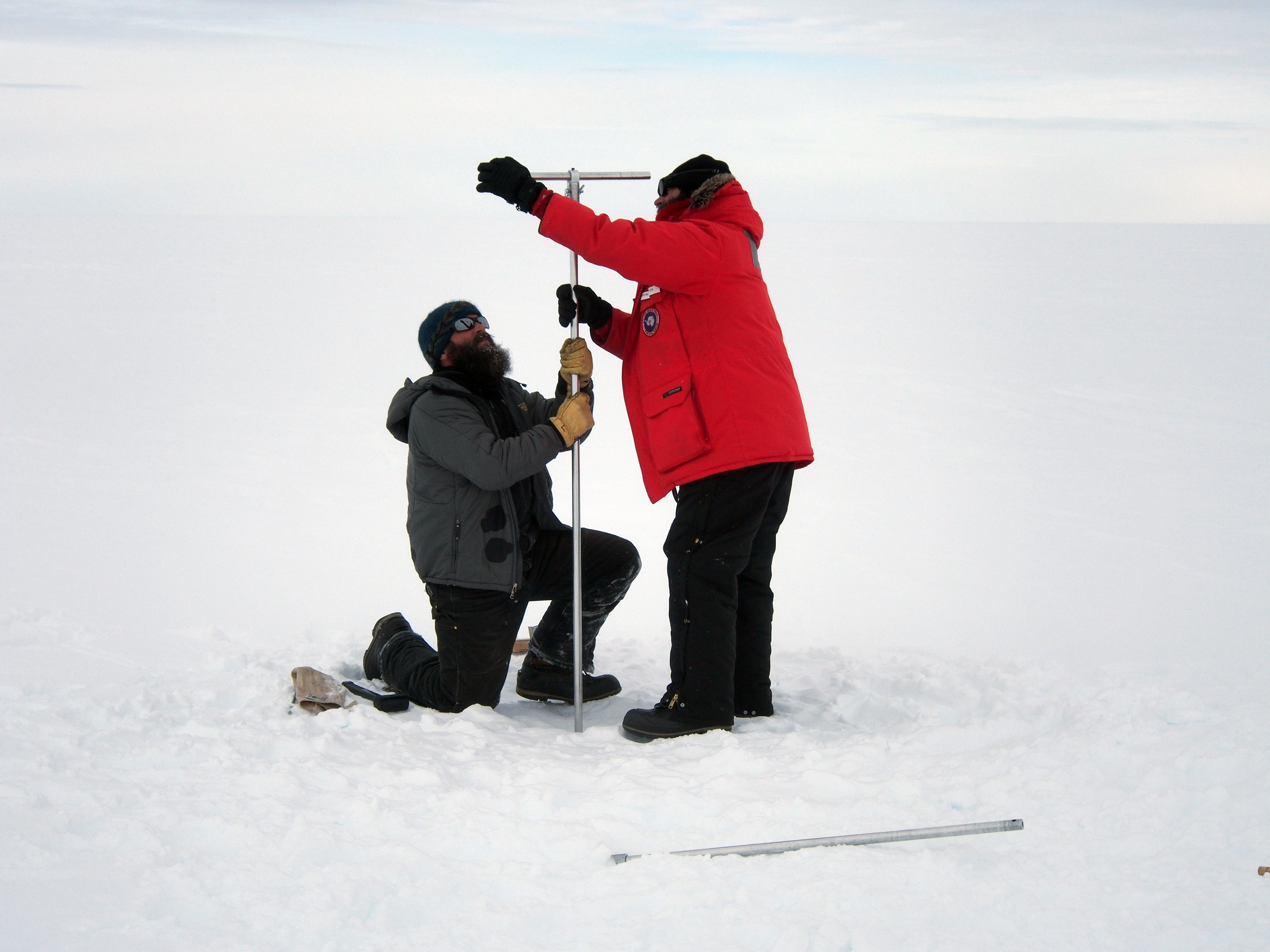
Fig. 7: Jeremy Miner and Ross Beaudette drill a shallow ice core, WAIS Divide, Antarctica. Photo: Bradley Markle.
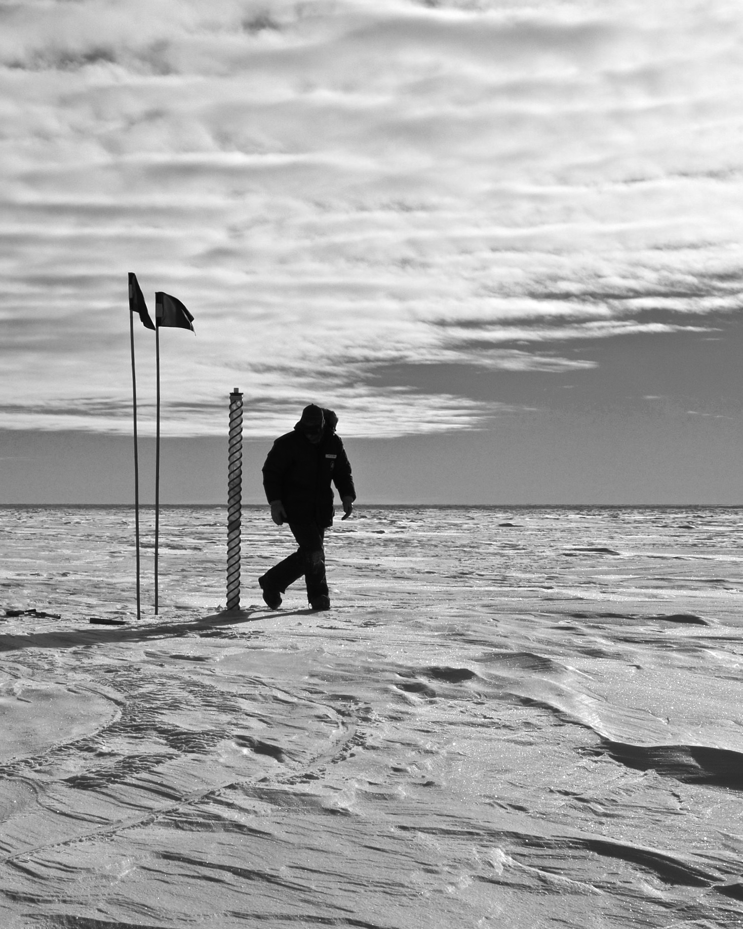
Fig. 8: John Fegyveresi drills a shallow ice core near the main WAIS Divide Camp, West Antarctica. Photo: Bradley Markle.
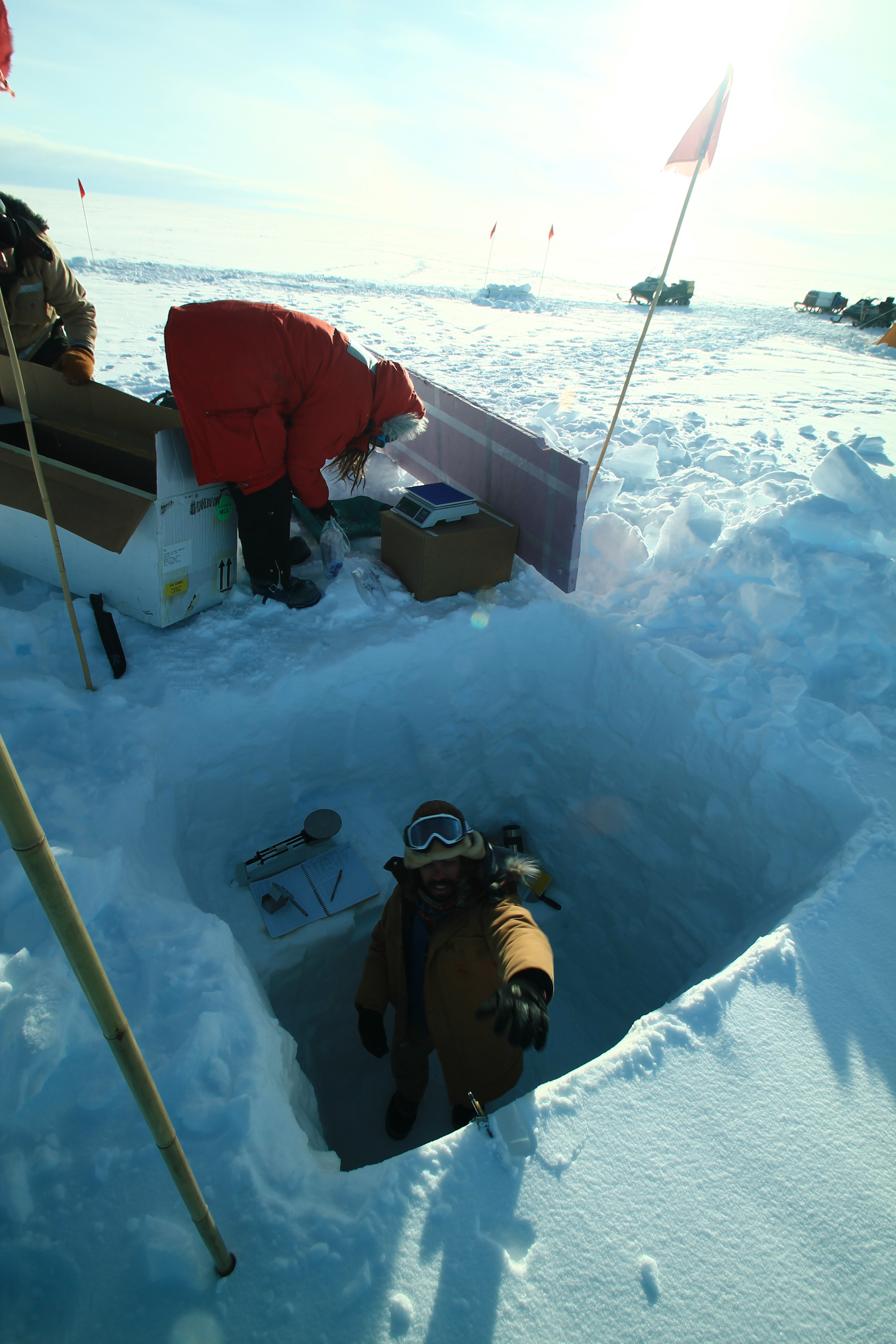
Fig. 9: John Fegyveresi, Emily Longano, and Brad Markle sample a snow pit for stable isotopes and density measurements, WAIS Divide Antarctica. Photo: Graham Colegrave.
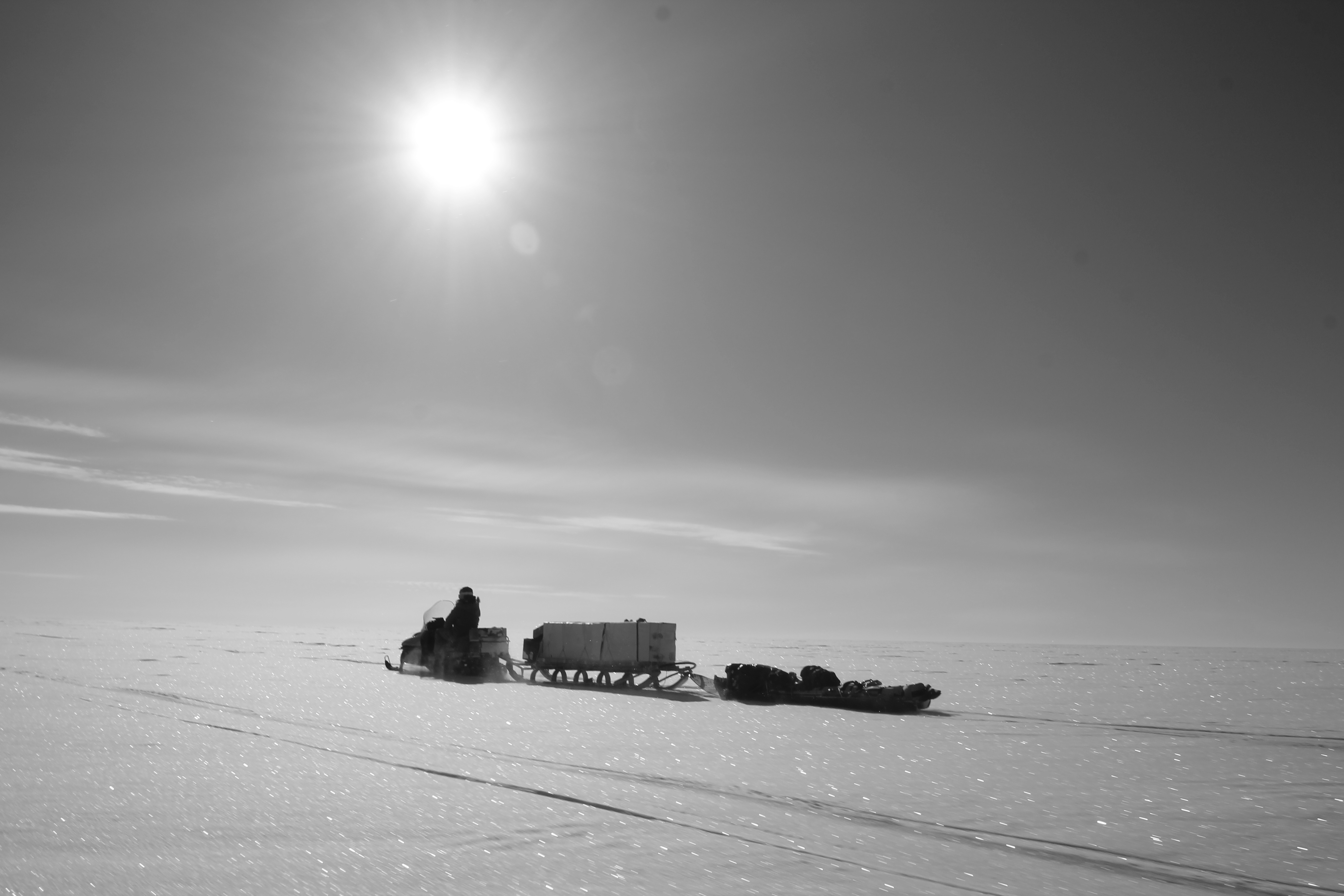
Fig. 10: Brad Markle transports shallow ice cores back to WAIS Divide Camp from a field site. Photo Graham Colegrave.
Supplementary Science #2: Investigation of Physical Properties at the WAIS Divide Site - John Fegyveresi
On-site, I calibrated and installed (with the help of Brad, Emily, and Ross) five platinum thermistor sensor strings in order to obtain a long-term, near-surface temperature profile over a two kilometer survey line. The purpose of this sensor array deployment is to better quantify the temperature fluctuations in the upper 5 meters of firn and determine if there is a correlation to specific surface features and metamorphism that have been noted at WAIS Divide over the past few seasons. It is hypothesized that these noteworthy features are caused under specific meteorological conditions and under varying degrees of solar radiative exposure and penetration at the surface. Varying temperature gradients in the upper few meters of firn may be modulating differing degrees of vapor flux through near-surface. The survey line was laid out in an upwind (grid-west, true-north) direction starting near the on-site Automatic Weather Station (Kominko-Slade), which also houses a solar, net-radiometer sensor that I installed last season (11/12). The thermistor strings were calibrated over a 60 minute period using a constantly-stirred ice-bath method, and were then deployed over a 10 day period starting December 15th. The sensor strings were spaced at 10 meter, 100 meter, 1000 meter, and 2000 meters intervals from the origin string at the AWS, and were taking measurements every 1 minute. Platinum thermistors were used as they allow for higher accuracy measurements, and respond to temperature changes more linearly that standard thermistors. 12V batteries were swapped out periodically to ensure that the sensor strings were constantly recording. During each site visit, photographs were taken and local meteorological conditions were noted (as well as any observed surface observations). Net accumulation was also noted. Lastly, firn density measurements were also taken at two of the five sites. Initial build and design of sensor strings was done at Penn State with the help and guidance of Atsuhiro Muto (post-doc researcher).
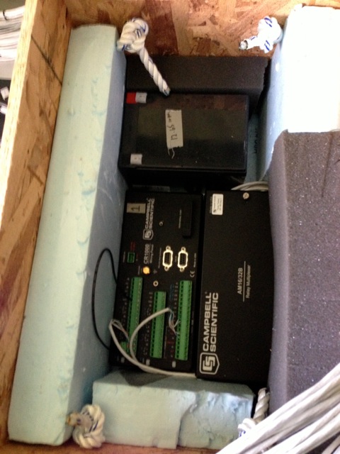
Fig. 11: Building a logger housing-box. Photo: John Fegyveresi.
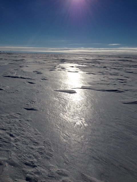
Fig. 12: Surface "glaze" photographed this year on Dec 23rd - 24th (GMT). Photo: John Fegyveresi.
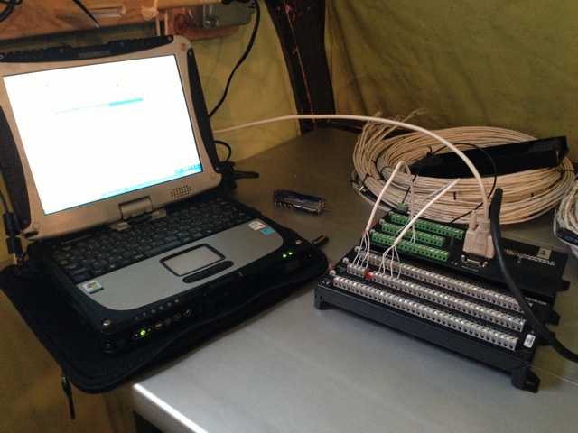
Fig. 13: Programming and testing a logger. Photo: John Fegyveresi.
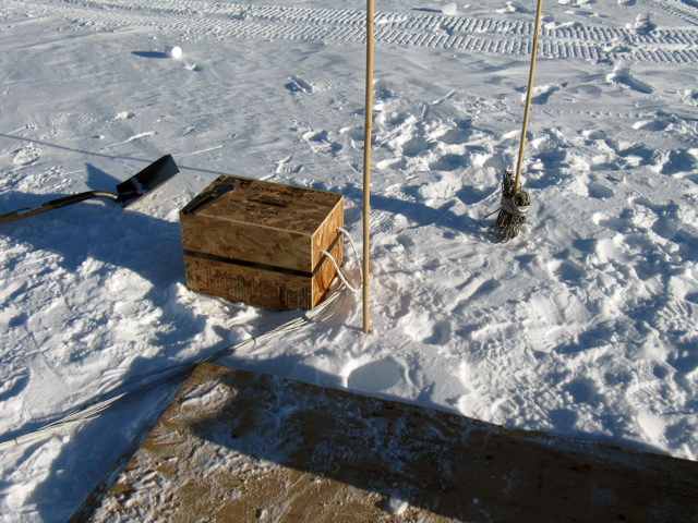
Fig. 14: Setting up logger station (drilled 5-meter hole can be seen). Photo: John Fegyveresi.
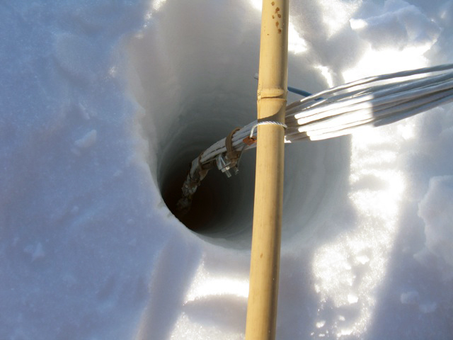
Fig. 15: Installing the thermistor string. Photo: John Fegyveresi.
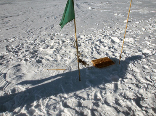
Fig. 16: View of the thermistor set-up after installation is finished. Photo: John Fegyveresi.
Supplementary Science #3: A Snowpit Study of Visible Snow Stratigraphy and Preservation of Volcanic Signals - Kari Peterson and Jihong Cole-Dai
Kari Peterson and Jihong Cole-Dai (South Dakota State University) excavated a 2.50 m snowpit near the WAIS Divide Camp. Snow layers of different appearance and other physical characteristics were recorded to generate a stratigraphic description that will be used to determine the patterns of snow layers useful for identifying chemical indicators of seasonal snow. Three sets of snow samples of vertical sequence in the snowpit were collected. They will be analyzed in the South Dakota State University lab for chemical composition of the snow. The analytical results will be used to determine if two recent (2009 and 2011) small but explosive volcanic eruptions are recorded in the Antarctica ice sheet. In addition to stratigraphy and sampling, snow density was measured in the field with a density sampling tool from the Berg Field Center and another density kit provided by John Fegyveresi of Penn State University.
Acknowledgements:
There was great support from the Antarctic Support Contractor during the season. We were able to start using the replicate drilling equipment down hole about 10 days sooner than we anticipated. This early start occurred because of both good weather when we needed it to get people and equipment in to camp, and also because of the great support we received from the camp staff, led by Camp Manager Kaija Webster. We would also like to thank Terry Jordan, and his assistant Nate Bourassa, for their hard work keeping the generators operating this field season with limited parts and supplies. Michael Davis' cargo support, the NYANG's fixed wing and cold-deck support, and Steve Mikel's SAFECORE reefer support were also critical to the success of the field season. This project would not be possible without the dedication and continual support of Julie Palais, Brian Stone and George Blaisdell.

